CityGML
Published Date: April 4, 2025, 1:18 p.m. || Abin Prajapti 399 views
CityGML stands for City Geography Markup Language, which is an XML-based format developed by Open Geospatial Consortium (OGC) representing urban features like buildings, vegetation, transportation, and infrastructure in 3D models. It provides a standard model for describing 3D objects with respect to their geometry, topology, semantics, and appearances.
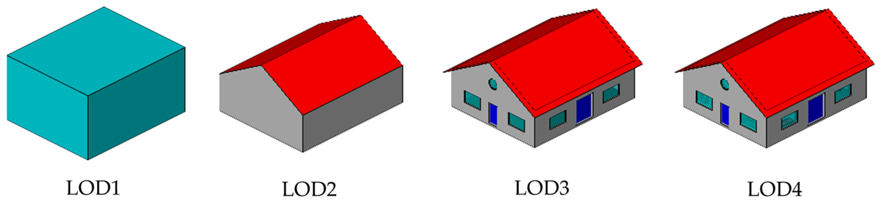
Level of Details (LOD) in CityGML:
- LOD0: Basic Level, which represents the terrain.
- LOD1: Extruded block models
- LOD2: Coarse prismatic model with multiple semantic classes (roof, wall)
- LOD3: Architecturally detailed model with windows and doors.
- LOD4: Detail models with interior details like walls, floors, and furniture.
CityGML can be applied in Infrastructure and facility management, smart city application, urban planning and simulation, and many more.
Geospatial Category
Recent Posts